With the Economic Transformation programme in place, Malaysia has since placed strong emphasis on oil and gas projects. Pengerang was slated as one of the sites due to its strategic location and major international shipping lines.
The Pengerang Integrated Petroleum Complex (PIPC) is one of the largest pieces of investments in Pengerang district and located on a single plot measuring about 20,000 acres. The project houses oil refineries, naphtha crackers, petrochemical plants as well as a liquefied natural gas (LNG) import terminal and a regasification plant.
As of January 2013, two major catalytic projects were committed within the PIPC area; (a) a RM5 billion Pengerang Independent Deepwater Petroleum Terminal (PIDPT) and (b) PETRONAS’ RM60 billion Refinery and Petrochemical Integrated Development (RAPID) Project.
With such a mega-scale development across Pengerang, many of the sites were reclaimed, routes were diverted and settlements rehoused.
Pengerang had been one of my favorite destinations, with its vast rural-scape, greeneries and long stretches of roads with sparse traffic. But now, it may or may not be so anymore….
Despite all these developments, I decided to make my way there on 22 to 23 August 2015 (Sat to Sun) to check out the new route.
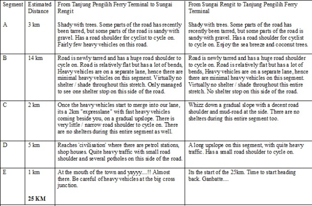
The ‘new route’ is now 25km instead of the old 18km route. There are signages pointing to the new route and one is not likely to lose his / her way if you keep a look-out for the signages. I will go into detail of the route by breaking it down into several segments (A, B, C, D & E). The old route is denoted as Segment X. I hope this provides a little insight for those of you who are keen to cycle into Sungai Rengit anytime soon.
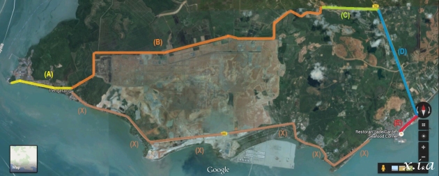
The New Route labelled as Segments A to E. The old route, Segment X is now closed till 2016. The entire (brown) area in-between Segment B and Segment X is now being reclaimed for the old and petroleum projects.
GETTING FROM TANJUNG PENGILIH FERRY TERMINAL TO SUNGAI RENGIT TOWN
Segment X
The ‘old 18km route’ is now closed and there is no way to get to Sungai Rengit town using this route anymore.
Segment A
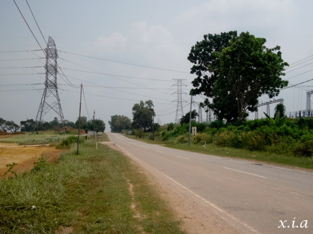
After exiting Tanjung Pengilih Ferry Terminal, one would need to travel about 3km on the ‘old route’ before it gets diverted to the new route. Some parts of this route has recently been tarred, whilst there were several segments which were still sandy with pebbles and gravel. There is fairly few heavy vehicles on this stretch.
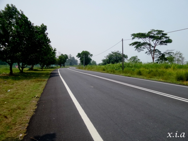
The first stretch of the route once you exit the Tanjung Pengilih Ferry Terminal. Some parts of it are newly tarred, which is really comfy to cycle on.
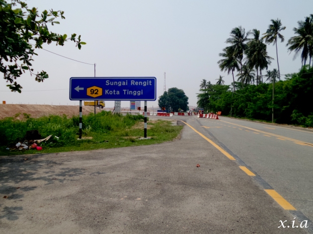
The first left junction. Once you see this signage, its time to turn left. You won’t miss it cos’ there’s no other route. The straight road (old route) is being blocked and manned by a security who will chase you off should you try to trespass and get through from there.
Segment B
After a left turn from Segment A, I entered into Segment B.
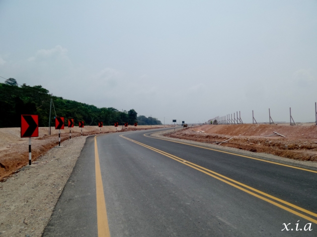
Segment B has been nicely tarred and there is a generous road shoulder for cyclists like us. This segment has lots of bends and a lady that I was chatting with at the ferry terminal, mentioned that there are 17 bends on this route. I’m not sure how true as I lost count halfway into the route. Haahaa… 🙂 There are actually few heavy vehicles on this route as there is another dedicated lane for heavy vehicles on the right side of the road. Throughout this entire 14km, I only managed to catch one hut that one could seek shelter in, should I run into a heavy downpour or storm.
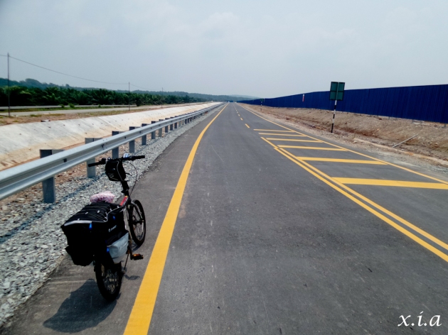
It is relatively quite an easy stretch to cycle on, with a generous road shoulder and minimal heavy vehicles. However, there is virtually little / no shade throughout this entire 14km stretch.
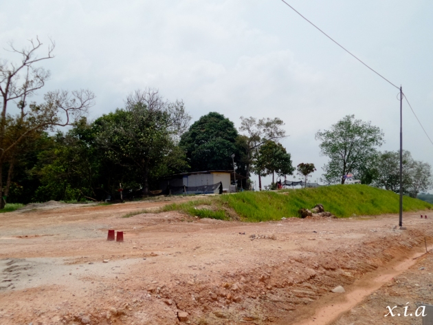
Apart from this small hut quite a distance away from the main road, I did not see any other ‘shelter stops’. Could be quite dangerous if one runs into a thunderstorm or downpour whilst cycling on this route.
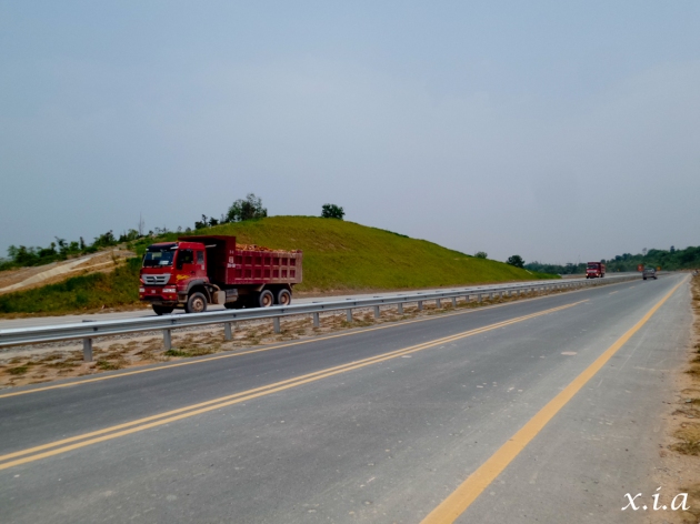
In Segment B, huge heavy vehicles has a dedicated lane on the right to travel on. Hence, there are few / minimal heavy vehicles on this stretch.
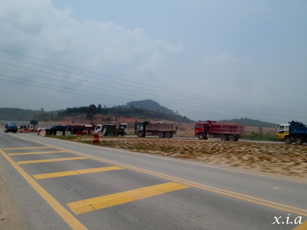
Segment B is rather easy with few heavy vehicles. However, once you get to this junction where lots of these heavy vehicles merged into the road that you will be travelling on, Segment C becomes a little more challenging.
Segment C
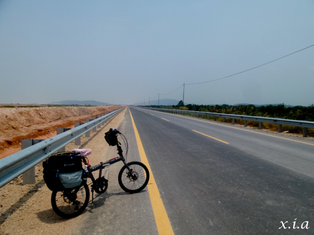
Once these heavy vehicles started to merge into my route, I came to an “expressway segment”. Although this was only a 2 km stretch, it was pretty challenging as there was virtually no more road shoulder for me to cruise on and heavy vehicles were just whizzing past me at high speeds. There was no way I could stop, as there was also no ‘space’ for me to stop at. I had no choice but to pedal non-stop through this entire segment with a short climb on this route.
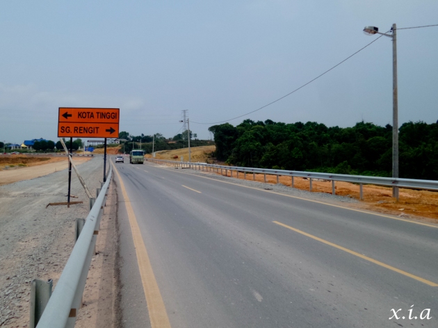
Only had time / space to stop to take one pic on this segment of the road. Road shoulder was very narrow with a curb by the side. Could hardly cycle within the road shoulder and heavy vehicles were just whizzing past.
Segment D
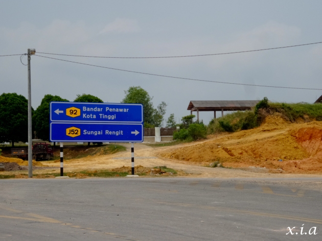
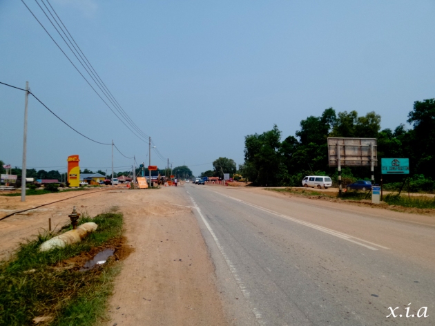
After I struggled up Segment C (non-stop), how glad was I when I reached the end of it. At the end of Segment C, there is a signage here, indicating a right turn to Sungai Rengit or a left turn to Kota Tinggi. I did a right turn here and headed to Sungai Rengit. There is a bit more civilisation here with petrol stations, shop houses etc. Traffic is heavier here, but there is a small road shoulder at the side. However, do note that this route has quite a number of potholes and do keep your eyes peeled on the grounds and on the front for this 5km stretch.
Segment E
At the end of Segment D, I arrived at this junction. A right turn brings me into Sungai Rengit town and a left turn brings me to the Kuan Yin temple, towards Desaru / Tanjung Balau via the coastal route. However, I have not gone on this route for quite a while and I’m not sure if there are any latest developments on this coastal route to Desaru / Tanjung Balau.
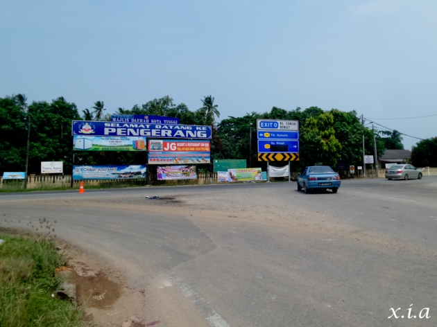
At the end of Segment D, you will come to this huge junction, which is at the mouth of the town. Turn right to get into Sungai Rengit or left to go towards Desaru / Tanjung Balau via the coastal route.
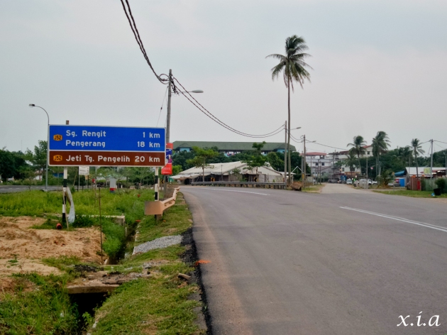
As it is, I made a right turn into Sungai Rengit town. This is the last leg and you should reach the town in less than 1km or no more than 5 minutes once you see this signage.
Staying for the Night
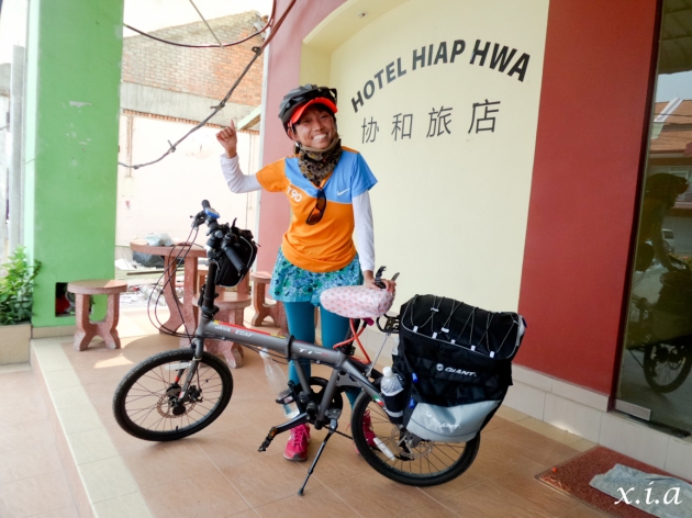
I checked into Hiap Hwa Hotel for my 2d 1n stay. They were not exactly the cheapest, but they were the only ones that I could book on-line beforehand. Most of the other hotels do not take bookings and in recent times, most hotels are fully booked for the weekends. If you are keen to stay for the night, I would strongly advise that you make a hotel reservation prior.
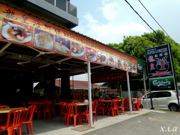
Lunch at Super Lobster
Despite that I was on my own, that didn’t stop me from having my lobster fix. I got to Super Lobster and ordered a Butter Lobster. OMG…..!! The Butter Lobsters really did make my 18km (from home to Changi Point Ferry Terminal) + 25km (from Tanjung Pengilih to Sungai Rengit) totally worth the ride. The Butter ‘flakes’ at the top were so soft and sweet which totally melted in my mouth! The flesh of the lobster was so juicy and tender…. Woooo…. Totally heaven…
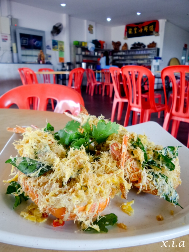
Super Lobster’s Butter Lobster. The Butter ‘flakes’ at the top were so soft and sweet which totally melted in my mouth! The flesh of the lobster was so juicy and tender…. Woooo…. Totally heaven… Made my 18km (from home to Changi Point Ferry Terminal) + 25km (from Tanjung Pengilih to Sungai Rengit) totally worth it… 🙂
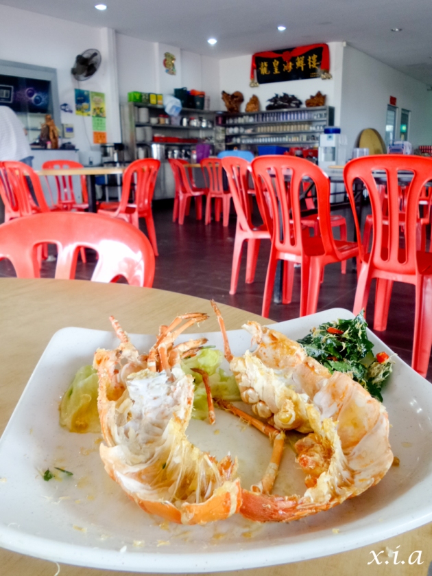
Nothing left… And just to remind you, I was there on my own and gobbled up this entire dish myself…!!
GETTING FROM SUNGAI RENGIT TOWN BACK TO TANJUNG PENGILIH FERRY TERMINAL
Segment E
It was pretty much the same route which I came from. From Sungai Rengit town, I cycled towards the Kuan Yin temple. Just slightly before the Kuan Yin temple, there is a huge juncture to turn left into.
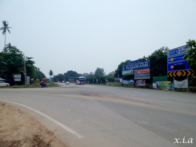
Turn left at this junction to head back to Tanjung Pengilih Ferry Terminal or go straight to get to Desaru / Tanjung Balau via the coastal route.
Segment D
On this side of the road, there are less potholes and there is a narrow road shoulder for one to cycle on. There is also a long climb up a gradual slope before hitting the juncture to turn left again.
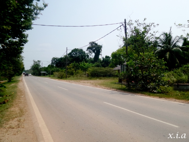
In this D segment, the opposite direction (going towards Sungai Rengit) was challenging with potholes. At this direction (going towards Tanjung Pengilih Ferry Terminal), there are less potholes and cycling was slightly easier as compared to the opposite direction, except for …. … (see next pic)
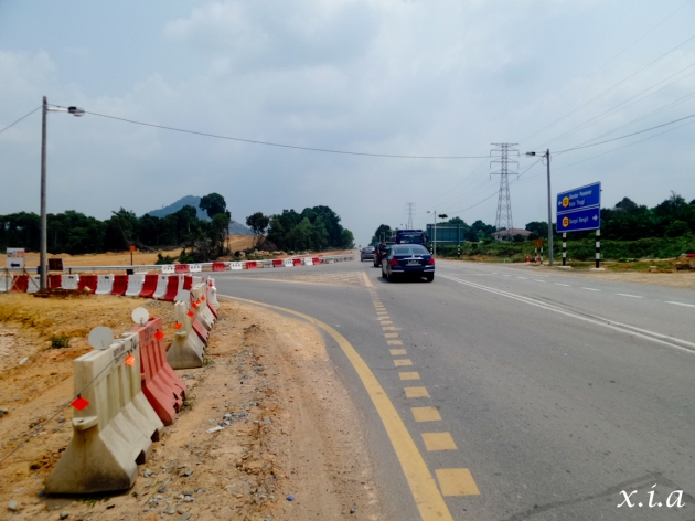
At the end of the upslope, turn left at the junction to go back to Tanjung Pengilih Ferry Terminal or go straight to get to Kota Tinggi via the highway.
Segment C
As compared to Segment C from Tanjung Pengilih to Sungai Rengit, the returning was much easier as there was a proper road shoulder as well as a long downslope to gain speed.
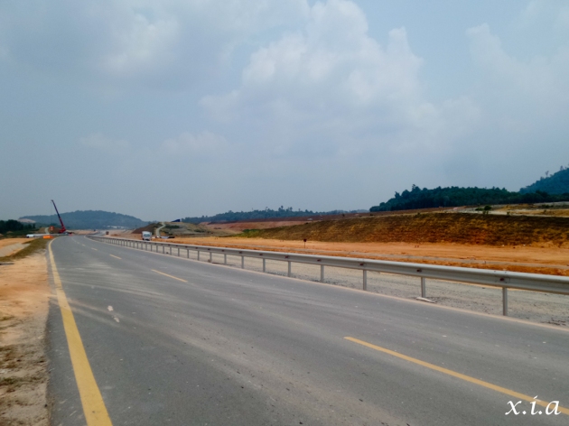
In Segment C (going towards Sungai Rengit town), the road shoulder was narrow and challenging. However in the opposite direction, it is very much easier with a wider road shoulder and long downslope.
Segment B
Segment B is the longest segment as compared to all the other segments, but I would say it was relatively easy and flat grounds throughout this segment, except for lots of bends to cover.
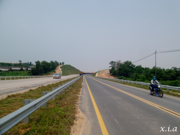
Segment B is the longest stretch at 14km, but it is rather manageable except that there’s virtually no shelter at all.
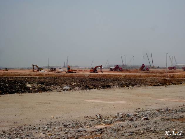
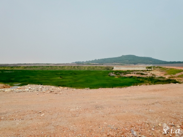
The amount of construction is really massive and the scale was much much much bigger than I could imagine.
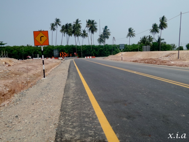
If you see coconut trees, breathe, breathe, breathe…. Cos you’re almost there. Follow the road and turn right to arrive at Segment A.
Segment A
This is the last segment and one of the more ‘enjoyable segments’ before arriving back at Tanjung Pengilih Ferry Terminal. There is lots of shade from the trees flanking the roads with the nice cool sea breeze from the sea just on your left.
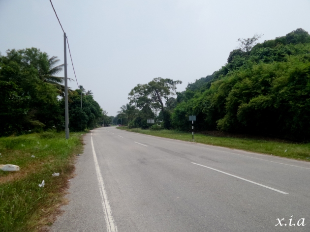
Once you get onto this stretch, enjoy the cool breeze from the sea and shade from the trees cos’ its only a mere 3km to arrive back at Tanjung Pengilih Ferry Terminal.
SUMMARY
Below’s a short summary of the route. Hope you have found this post useful.
- Stock up on hydration before departing for Tanjung Pengilih Ferry Terminal. Once you start pedaling on the 25km, there are no rest stops or shops for you to purchase any hydration or drinks from. There is a convenience store at Tanjung Pengilih Ferry Terminal which opens from Monday to Sunday, 8am to 6.30pm, with a lunch break from 1pm to 2pm. However, I was there at 2.30pm and they were still not open from their lunch break. Hence, dun bang on their operating hours and go prepared.
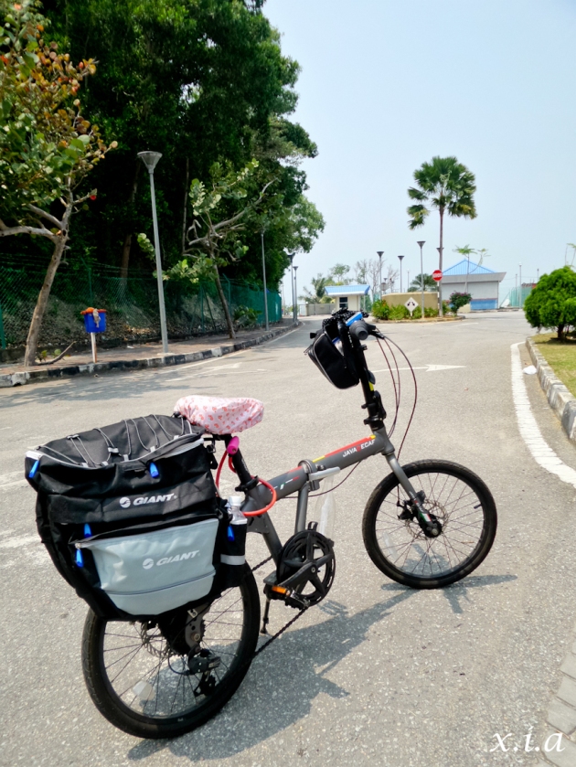
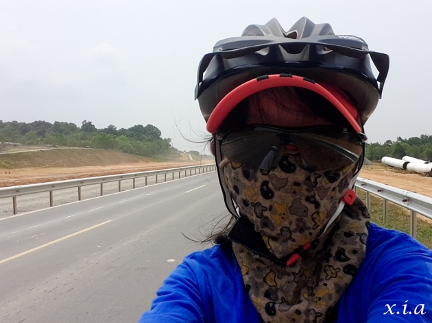
- Slap on adequate sun block, mask up and put on safety goggles to keep out the dust. A sample of Miss Kiasu picture below…. Haahaaa… 🙂
- Do not attempt to cycle during the rainy / stormy season as there are really little or no shelters for most part of the journey.
- Watch out for heavy vehicles. Have fun and keep safe.
- For those of you that are keen to cycle in Sungai Rengit, but ain’t able to get a cab at Tanjung Pengilih Ferry Terminal, you can try calling one of these cab-drivers; Mr Eng Ken Boon Hp# 013-783-4278 or Mr Tan Siew Chang Hp# 013-775-0098. Costs about RM32 for a 30 minutes cab ride from the ferry terminal to Sungai Rengit town, My friend who was there recently in late July, waited for more than an hour in a futile attempt to get a cab. Ultimately, they were pretty lucky to hitch a ride into town.

Hi Xia,
Thanks for your excellent article! Very detailed, nice photos, very usefull, thanks for taking the time to mark out the map too!
When is the rainy season? Is it Dec to Feb?
Ciao
A
Hi Adrian ;
Thank you very much for reading. Glad you found the map useful.
Pengerang is in Johor and hence, follows pretty much the same weather as like in Singapore. Yup, the rainy season would be the same as us here, from Dec to Feb. Do try to avoid going during the rainy season as there are hardly any shelters during most part of the route. It can get quite dangerous should one run into any lightning storms. Have fun and keep safe 🙂
Thanks for all the info on the condition of the new route. We have the done the old route many times going back 14 years but will try the new route you have described soon.
Two oldie cyclists
Thank you for reading, Peter. This new route is rather dusty without much shelter. Keep safe and hydrated if you intend to go on the route, ya. Take care and have fun.
Hi Xia,
Hope this reply find you well!
I always wonder about the changes in Pengarang before i have reached your articles. Very thankful for the sharing and by far this is the most updated info, hence it gives me a good head up as i will plan the cycling route with it for my upcoming trip to Desaru via this new route next month.
Xia please continue your sincere, cute and friendly touch to your future postings about trips. I am really enjoy reading your blog.
Terrence
Dear Terrence ;
Thank you very much for reading and the great encouragement. That really gives me a lot of adrenaline to continue writing… 🙂
For your trip to Desaru next month, how much time are you planning to use to cover the trip? If you are intending to cover it in 1 or 2 days, perhaps you could take the same route (in the above map) from Tanjung Pengilih ferry terminal to Desaru using one of the below 2 options;-
Option 1 :
After Segment C, instead of turning right into Sungai Renggit, you could turn left onto the route towards Kota Tinggi. However, do note that this route is more of an ‘expressway’ with heavier and fast moving vehicles. Be alert and careful when cycling on this route. But I reckon this route might be slightly faster than the coastal route in option 2.
Option 2 :
After Segment D, instead of turning right into Sungai Renggit town, turn left and go on the ‘coastal route’ towards Desaru (you should pass by a Kuan Yin temple on your left). This route has relatively lesser traffic and a bit more scenic since it is by the sea. However, in recent times, this route is getting reclaimed and there are more constructions going on. Keep a look out for pot holes, gravel and sandy surfaces.
If you have a bit more time and would prefer to take it slow and easy, you may want to consider option 3.
Option 3 :
Finish segment A to E. Check into a hotel at Sungai Renggit town for the night and then disembark again the next day. Go in the direction towards Tanjung Pengilih ferry terminal. After covering Segment E, instead of turning left to Tanjung Pengilih ferry terminal, go straight ahead (you should pass by a Kuan Yin temple on your left) and you would get onto the ‘coastal route’ to get to Desaru. This route has relatively lesser traffic but a bit more rolling hills to cover.
Take care, have fun and keep safe on the road. Be alert and keep a look out for vehicles as well. And very very very importantly, go prepared with lots of hydration and isotonic drinks 🙂
Xia,
Thanks you so much of your advices and options. We are tend to relax and easy so coastal line would be the option. Now the only left wondering is the so called segment ‘F’ ( route from Sg Renggit towards Desaru via coastal line) as I not been there for quite sometime back. So see how we should go on that day and hopefully no confusion. As we have already got a place and will spend a night at Desaru.
Xia I will share with you next time about this trip and update for your future reference especially the coastal line part toward Desaru. Talk to you next time!
Terrence
Dear Xia
thank you for posting. It really helps to answer a lot of questions. I am planning my 1st bike adventure using your itinerary. 🙂
I’m very impressed how at ease u look!
I’m new to going long distance on the bike. Do you think this is achievable for an average fitness person? any safety concerns for solo female cyclist?
btw I’m looking at the last week of Dec to do this. Any advice on whether this a bad time?
Hi Stellarlynx ;
Thank you very much for reading.
I’m just another average fitness person as well, hence, I believe if I can do it, you can do it too!
As a fellow solo female cyclist, my advice is to stay alert and vigilant on the roads. Avoid stopping at or near construction sites or deserted small lanes. Wear bright coloured clothings, keep to the main roads and switch on your hazard lights so that you remain highly visible throughout the ride.
Pengerang is in Johor and hence, follows pretty much the same weather as like in Singapore. Yup, the rainy season would be the same as us here, from Dec to Feb. Do try to avoid going during the rainy season as there are hardly any shelters during most part of the route from segments A to C. It can get quite dangerous should one run into any lightning storms.
Take care, have fun and ride safe 🙂
Hi Xia,
How did you book Hiap Hwa online? Called a few hotels including Hiap Hwa. All fully booked and unable to confirm availability of rooms on weekend, due to the construction work.
Hi Jeremy;
It is indeed more difficult to get a room these days due to the construction works in Pengerang area. Usually, I’ll Facebook Message Hiap Hwa Hotel to book a room one or two weeks in advance. They are usually quite fast in responding. Most of the other hotels do not want to commit to providing us with a room over the phone or online, lest we do not turn up and in which they might incur loss sales opportunities.
Hiap Hwa Hotel would likely request that you do a POSB bank transfer as a deposit for the first time round. Try to message Hiap Hwa via their Facebook. If not, you may want to try to watsapp them at the below number too.
Hiap Hwa Facebook : https://www.facebook.com/Hiap-Hwa-Hotel-128905707204957/#_=_
Hiap Hwa Watsapp Number : Nisa +60 16-715 6222
Hope the above helps. Do let me know if you manage to get hold of them, if not, let me see what I can do for you.
Have a good and fun trip in Pengerang, ya 🙂
[…] Top photo from Hoh Siow Har’s blog. […]
Thanks for sharing your bike journeys! I’m a noob at this, so got a few questions hope to hear your advice…noticed you rented bikes previously, but now you are driving foldie in..any issue bringing own foldie along? Will the roads be very dusty and hence need a washdown after?
Do you use any GPS to navigate the roads? Or research on the roads prior to trip and rely mainly on the road signs?
Thanks for detailing your trips!! 🙂
Hi there;
Thank you for reading.
In the past, when we arrived at Tanjung Pengilih ferry terminal, we would take a cab to Sg Renggit town and rent a bike from SHH Motors (a bike shop at Sg Renggit town). However, with the new construction works and detour, the distance from Tanjung Pengilih to Sg Renggit town is now 25km instead of the previous 18km. Hence, many cab drivers are no longer as willing to make the detour to the jetty and await passengers. The wait for a cab could range from 15 minutes to over an hour. As such, we decided to bring our own bikes (or rent one from Changi Village) and cycle from Tanjung Pengilih ferry terminal to Sg Renggit town.
The main issues from bringing your own bike are that you would need to lug your bike in and out from the fibre boat / bum boat. Thereafter, you would need to endure the dust and winding roads to cycle 25km from Tanjung Pengilih ferry terminal to Sg Renggit town. The signages are rather clear and large and I personally didn’t use any GPS. But of course if you would prefer to rely on a GPS, you could too. You could do some research on the roads as well, but nothing beats being there yourself because the roads are “evolving” every single day with the constructions.
The roads are getting quite dusty as well. It would be good to give your bike a washdown after the trip if you have some time to spare, so that it could last longer and perform better for the days ahead.
Have fun and keep safe cycling from the ferry terminal to the town as there are huge vehicles at certain segments of the route. Slap on more sunblock and keep hydrated as the road is quite exposed with little shelter. Grab your hydrations from Singapore before you arrive Tanjung Pengilih ferry terminal. I hope the above helps 🙂
Hey Xia, thanks a lot for the tips! 😉
Thank you!! Very very useful post indeed! Very helpful for people like me who are thinking of cycling at pengerang but not knowing how’s the situation there like now with the construction at all! Thank you for publishing this!
No worries at all, Grassbreath.
Thank you for reading.
The constructions at Pengerang is evolving so much and so fast, every single day. The distance from Tanjung Pengilih to Sg Renggit town is now 25km instead of the previous 18km. It has also gotten much dustier with heavy vehicles transporting materials to the construction sites on the route. A large segment of the route is un-sheltered and one would need to cycle under the blazing hot sun negotiating the bends and gentle up and down slopes. However, the good part is that there is quite a generous road shoulder which we could cycle on, without getting onto the road traffic.
If you are keen to go, I would strongly suggest for you to mask up (nose & mouth) + sun shades / safety goggles so as to prevent inhaling of the dust as well as them getting into your eyes.
I would also encourage you not to leave any parts of your body exposed as there is virtually no shelter at all for most part of the journey. I would usually don on arm sleeves, gloves for the hands, long pants, covered shoes with socks, helmet, face mask and sun shades.
I hope the above helps. Take care and cycle safe 🙂
Hi Xia,
Thank you for the detail information. Is Segment X route closed indefinitely? Plan to go someday but the new route doesn’t seem interesting anymore.
Hi Sam;
Thank you for reading. It does seems like Segment X is closed indefinitely and permanently according to one of the town folks at the provision store.
The new route is rather exposed and dusty and has lost its charms of the old scenic kampung route for now.
We could perhaps visit again after all the construction works to see if they would line the routes with trees once more.
It is a shame that such a quaint little town had undergone such tremendous developments, destroying the peace and tranquility it once had.
Hi! Do you know hows the route like now from the jetty to sungei rengit? My friend and I are planning to go this Dec but I’m unsure of the route, if there have been any changes over the past one year!:) thank you!
Hi grassbreath;
Our last visit to Sg Renggit was in July this year (2016). At that time, it got really dusty and very much exposed, and hence we have pend our visits to Sg Renggit till the construction works are over. I am not really sure about the road conditions as of now. If you happen to go, do keep me updated. Heh hehh… Take care and have a good and safe time 🙂
thanks lots for your prompt responses always and helpful replies! Sure! been finding how the road is like now on the web and realise it is abit difficult to find updates about it so will surely update when i’m back! By the way can i check if google map route is the same way as your route? Might be following the map by google map to know the entire way. haha thanks! your pictures definitely help alot too!
Hi Grassbreath;
I have just checked Google Map as below link and it is still pretty much the same as the route that I mapped out in this post.
https://www.google.com.sg/maps/dir/Tanjung+Pengelih,+Pengerang,+Johor,+Malaysia/Sungai+Rengit,+Kampung+Sungai+Rengit,+Pengerang,+Johor,+Malaysia/@1.373761,104.1550122,7796m/data=!3m1!1e3!4m14!4m13!1m5!1m1!1s0x31da30822d4c70f7:0x2ce06637060d52ec!2m2!1d104.103049!2d1.367792!1m5!1m1!1s0x31da324f8def5881:0x6b54b3a4b03ac75f!2m2!1d104.226196!2d1.352933!3e0
You can use Google map or keep a lookout for the big signages on your way to the town. You should see three big signages / junctions along the way;
(1) After segment A and before segment B, where you should be turning left.
(2) After segment C and before segment D, where you should be turning right.
(3) After segment D and before segment E, where you should be turning right.
It should not be too difficult cos’ there’s only one (obvious direct) route there. Do not go on the shortcuts or side roads since you are not too familiar with them.
As the route is very exposed, please slap on more sunblock or refrain from cycling when it is storming. I would also suggest you bring along your eye goggles and face shield as the roads could get quite dusty
Have loads of fun. Take care and keep safe when cycling there, ok 🙂
Good job. Thanks for the tips.
No worries, Hardy. Hope they had come in useful.
Thanks Xia, for your well done report and trip experiences to sharing to others. We are planning cycling trip to this route. wondering whether those heavy truck carrying soil are still operating now? and we are planning day trip, so you got any suggestion tips for the day trips?
Hi Robbin;
It has been quite a while since I’ve cycled to Sg Renggit as the roads got really dusty with all the construction works. I’m not really sure of the current situation.
If you are planning a day trip, try to catch the earliest boat at 7am or alternatively, pre-book the whole boat if you have 12 paxs.
Try to go early as you would need to cycle about 25km from Tj Pengilih ferry terminal to Sg Renggit town. Depending on one’s fitness level, it could range from 1 hour to 3 hours one way. The last boat departs Tj Pengilih at about 4pm. Hence, time yourself well and make sure you arrive in time if you are doing a day trip.
The road is rather dusty with little shelter. Don’t stinge on the sunblock and ensure all parts of the body is well-covered to prevent any sun-burn. Go prepared with more isotonic drinks and water to keep yourself hydrated during the ride.
Most importantly, ride safe and have loads of fun…. : )
We did the ride from pengerang up to Desaru a few days ago. We were at the Changi ferry terminal at about 8 am on a Sunday but there were very few passengers. We waited about an hour till the 6 passengers that were there negotiated to pay double to get the bum boat going. there used to be lots of passengers on Sundays but not now, so unfortunately this is not a reliable way to go unless there are enough of you to charter. coming back from pengerang could be worse. I just don’t think there are passengers doing this anymore after kampung jawa and the other kampungs were knocked down for the plant.
We started the ride around 10:15. Big changes since we last did the ride 2 years ago. So many new restaurants and workers. The first 2 sections were fine, lots of room, not much traffic. The last 2 sections were very dusty with many trucks and 4 WD. All the truck drivers were considerate but there wasn’t enough room. Very unpleasant and a bit dangerous.
Sungei Ringgit has traffic lights! It has really grown, I have never seen so many toyota hilux and ford ranger trucks in one place. Unfortunately traffic has really increased. We left the highway and took the coast road all the way up to the rocks, (the beach at the end). Still lots of nice kampongs and beaches to swim but someone is building a huge hotel in the middle of nowhere on the old road so those days are over perhaps,
The rest of the way to desaru was the same as before but Sunday traffic was heavy.
More development up near Penawar, a mall! A hotel. Stayed the night a a hotel in desaru
we enjoyed the ride, seeing the changes, we first did the ride 11 years ago and most years since.
We were lucky to have enjoyed the sleepy kampungs, the quiet roads back then.
they are gone forever now with the petro plant.
We left from the ferry in Belungkor which may be the most reliable way to go now and forget about pengerang. they are building a new highway from Penawr to Sungei Ringet to cope with the heavy traffic so it could be a better way to ride to desaru. not much to see though, just palm oil plantations. The ride from desaru to sungei ringet is still a nice ride.
Still an adventure if you are game
Hi Peter ;
Thank you for the update.
During our last trip there about 1 year ago, we waited for a really really long time when we used Changi Ferry terminal to get to Tanjung Pengilih. In the past, there were too many customers and not enough boats. Now, there are too many boats and not enough customers. I think we had 8 or 10 paxs and had to top up the difference too. It is indeed that gone are its glory days.
It is such a pity that redevelopment has totally crushed this quaint little town with beautiful kampungs, coconut trees and lalang fields.
I guess I should try getting to Sg Renggit from Belungkor one of these days too!
Thank you so much for sharing. I’m sure your information would be invaluable to many others who are thinking of doing the same too… : )
Thank you Xia for your interesting and informative site, some great adventures to be had